Lost civilisations
Troy
Under one Turkish mound lie nine main cities of Troy, up to 46 levels of habitation, and the layers Schliemann began digging through in 1870.

At a glance
9 cities
Main cities, Troy I to Troy IX, in the standard sequence
46 levels
Levels of habitation counted in the excavations
20 metres
Height of the artificial mound Schliemann attacked
5 metres
Thickness of the Troy VI fortification walls
1870
Year Schliemann began digging
A mound called the fortress
Hisarlik, Turkish for "the fortress", is an artificial mound beside the Küçük Menderes River on the Aegean coast of Turkey.
The mound lies about 4.8 kilometres from the southern entrance to the Dardanelles. Alluvial deposits from the river have since moved the site about 5 kilometres inland.
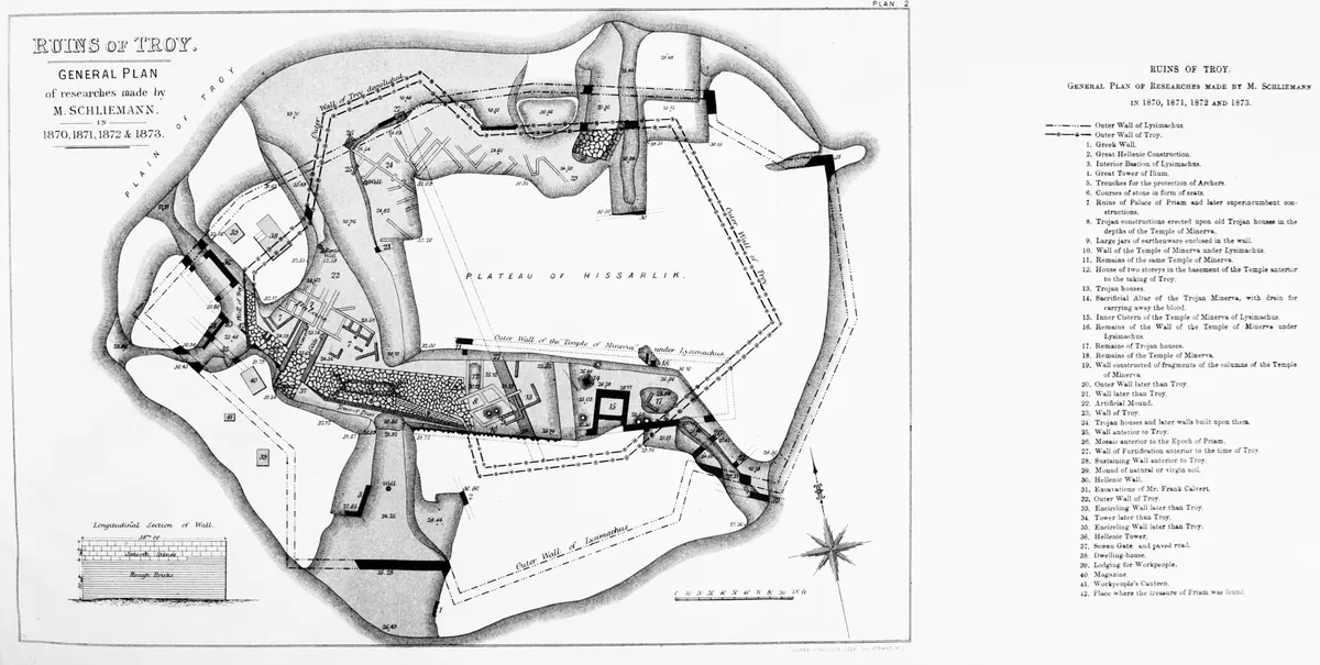
When Heinrich Schliemann began digging in 1870, he went for a conspicuous artificial mound about 20 metres high.
Frank Calvert dug trial trenches there in the early 1860s and bought a large part of the mound. In 1868 he handed the project to Schliemann.
Nine cities, or ten
The excavations revealed nine cities, numbered Troy I to Troy IX, and no fewer than 46 levels of habitation.
The count of cities depends on who is counting: a University of Wisconsin-Madison account describes 10 cities built one on top of another, some with clear evidence of violent destruction.
Schliemann found a sequence of seven cities. In the 1890s his assistant Wilhelm Dörpfeld investigated the plateau around the base of the mound, and that work extended the sequence to nine.
One chronology dates Troy I to about 3000 to 2550 BCE, while another dates it to about 2950 to 2350 BCE.
Troy VIII, the Greek Ilion, and Troy IX, the Roman Ilium, are dated together at about 950 BCE to 550 CE in one chronology. Another dates Troy VIII to about 330 to 85 BCE and Troy IX to about 20 BCE to 500 CE.
Carl Blegen counted 18 levels within Troy I and II, while Manfred Korfmann counted 22 and reclassified several strata once labelled Troy II.
Walls, fire and an earthquake
Troy VI, dated to about 1750 to 1300 BCE, had fortification walls 5 metres thick and up to 8 metres high, built from large limestone blocks.
Troy VI's lower town covered about 270,000 square metres, and one estimate puts the population at as high as 10,000.
Blegen attributed the end of Troy VI to a violent earthquake, not warfare. Livius also notes that the city was later found to have been destroyed by an earthquake.
Troy VIIa, dated to about 1300 to 1180 BCE in one chronology and 1300 to 1200 BCE in another, was destroyed by fire. It was looted and sacked, apparently after a war.
Pottery quality declined with the Troy VII decline, and handmade pottery returned after centuries of wheel-made wares.
Who dug it, and how
Schliemann dug from 1870 until his death in 1890. He removed layers showing no traces of fire while searching for a burned city, and destroyed some phases in his search for Priam's Troy.
A hoard of gold jewellery in the second city layer convinced Schliemann that he had found Troy.
Dörpfeld, Schliemann's former assistant, identified Troy VI as the Late Bronze Age city that existed alongside Mycenae.
Carl Blegen re-evaluated Hisarlik in the 1930s and took careful samples from each layer, unlike Schliemann.
Manfred Korfmann's University of Tübingen team found a densely populated lower city outside the citadel walls, which suggested that earlier diggers had mostly excavated the citadel area.
There was a 50-year gap in digging between 1938 and 1988. The Universities of Tübingen and Cincinnati then excavated at Troy from 1988 to 2012.
Sources
- History and Archaeology Online, Digging up Hisarlik, Part 1: The Search for Troy
- World History Encyclopedia, Troy
- University of Wisconsin-Madison, UW-Madison archaeologists to mount new expedition to Troy
- Livius.org, Troy: excavation
- World History Encyclopedia, Discovery of Troy